Home Page
Develop an interactive map application that provides automatic tour information about the areas on the SNC campus. This application would activate feedback on a device when near a point of interest.
After some discussions with the professors, we decided to remove the bluetooth aspect of the project and have the project use location based triggers instead of bluetooth based triggers. So the application still works pretty much the same as it would if it was using bluetooth.
1: Choose an appropriate path from the user's current location to a desired location (and adjusting path if user leaves the suggested path).
2: Augment the user's view to indicate direction to take.
3: Follow an appropriate path created by the application.
4: The application should check for updates when started so that additional locations and feedback can be added without reinstalling the app.
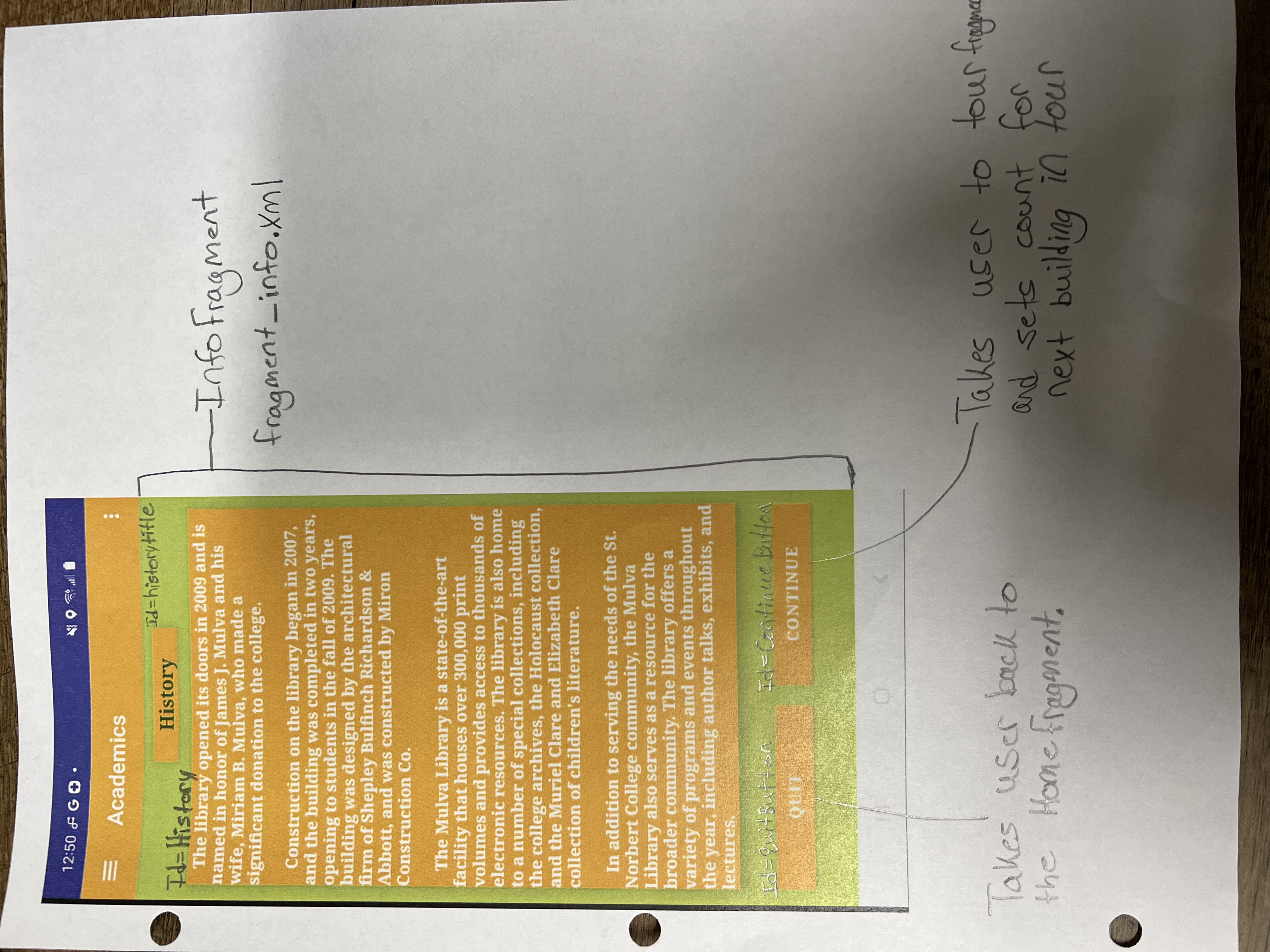
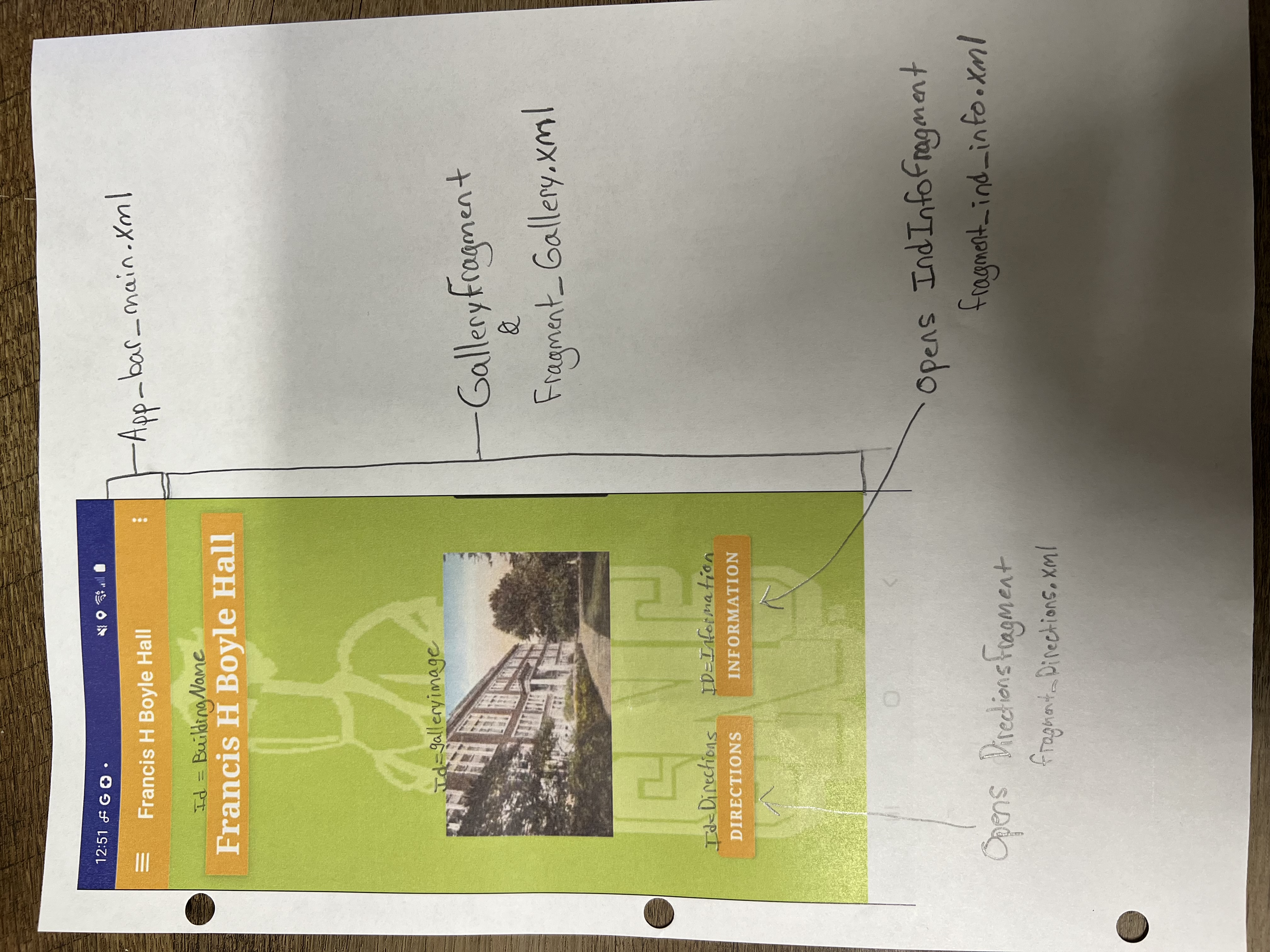
5: Different feedback should be available at each location.
6: Can two pieces of feedback be available simultaneously if near two locations? If so, how?
7: Indicate nearness to a location.
Below is a download link for my entire project. This link will download a compressed zip file containing a startup.txt that will explain everything you need to know and do to be able to run the project on your own. Also there will be a FileOverview.txt that gives a brief explanation of all the important files. All of my project code and the android studio application will be located in the sub folder called Capstone.
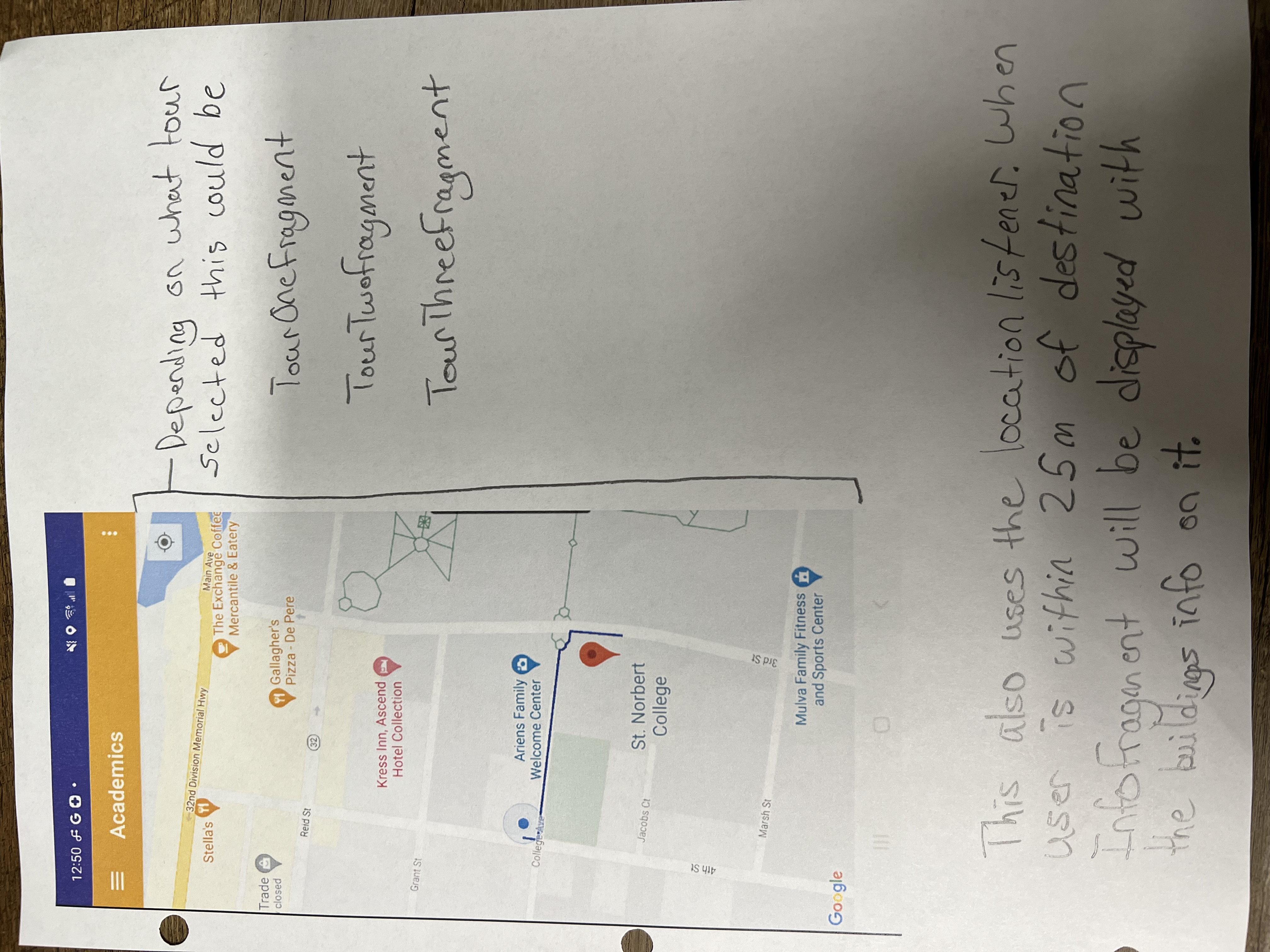
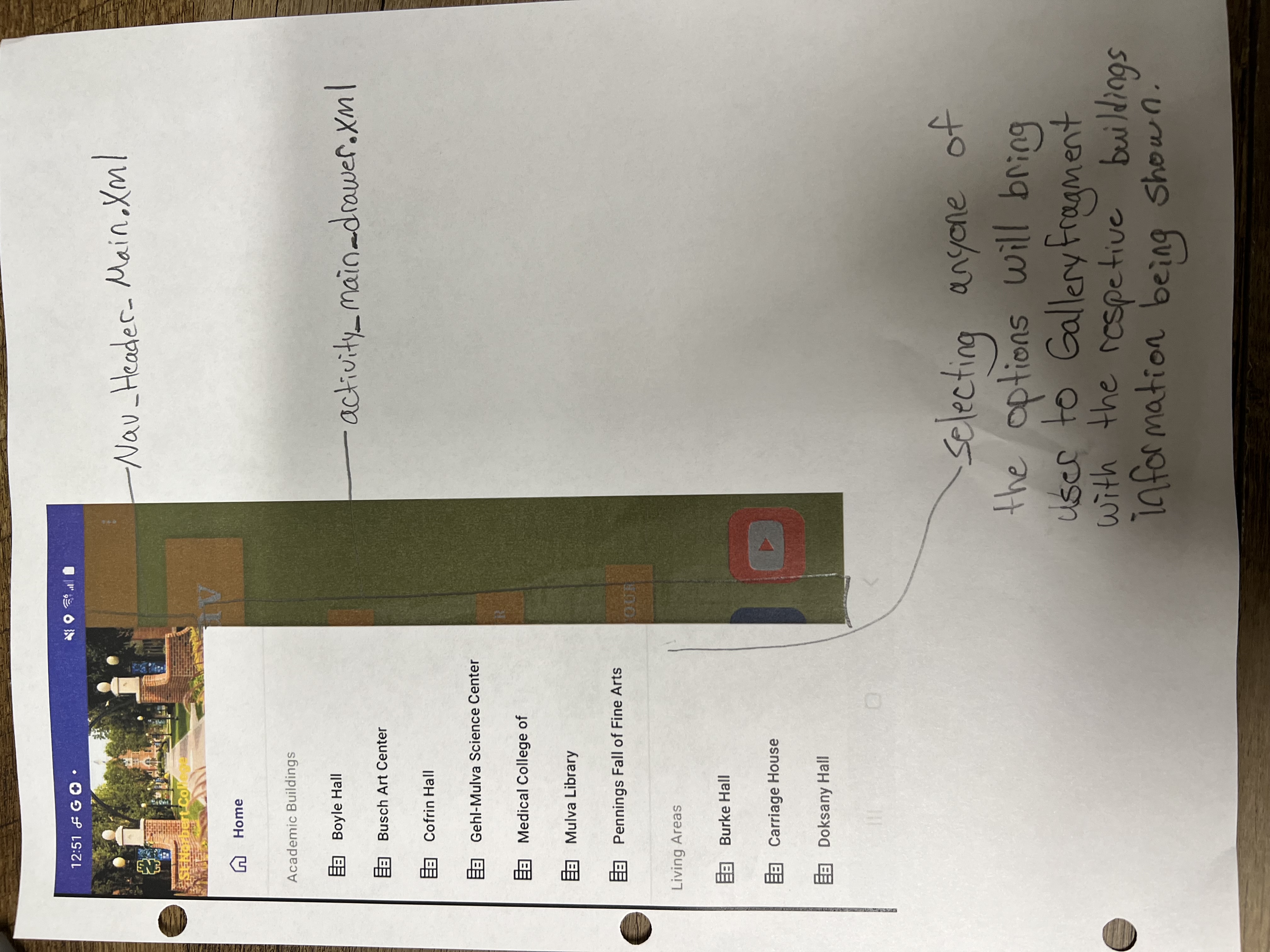
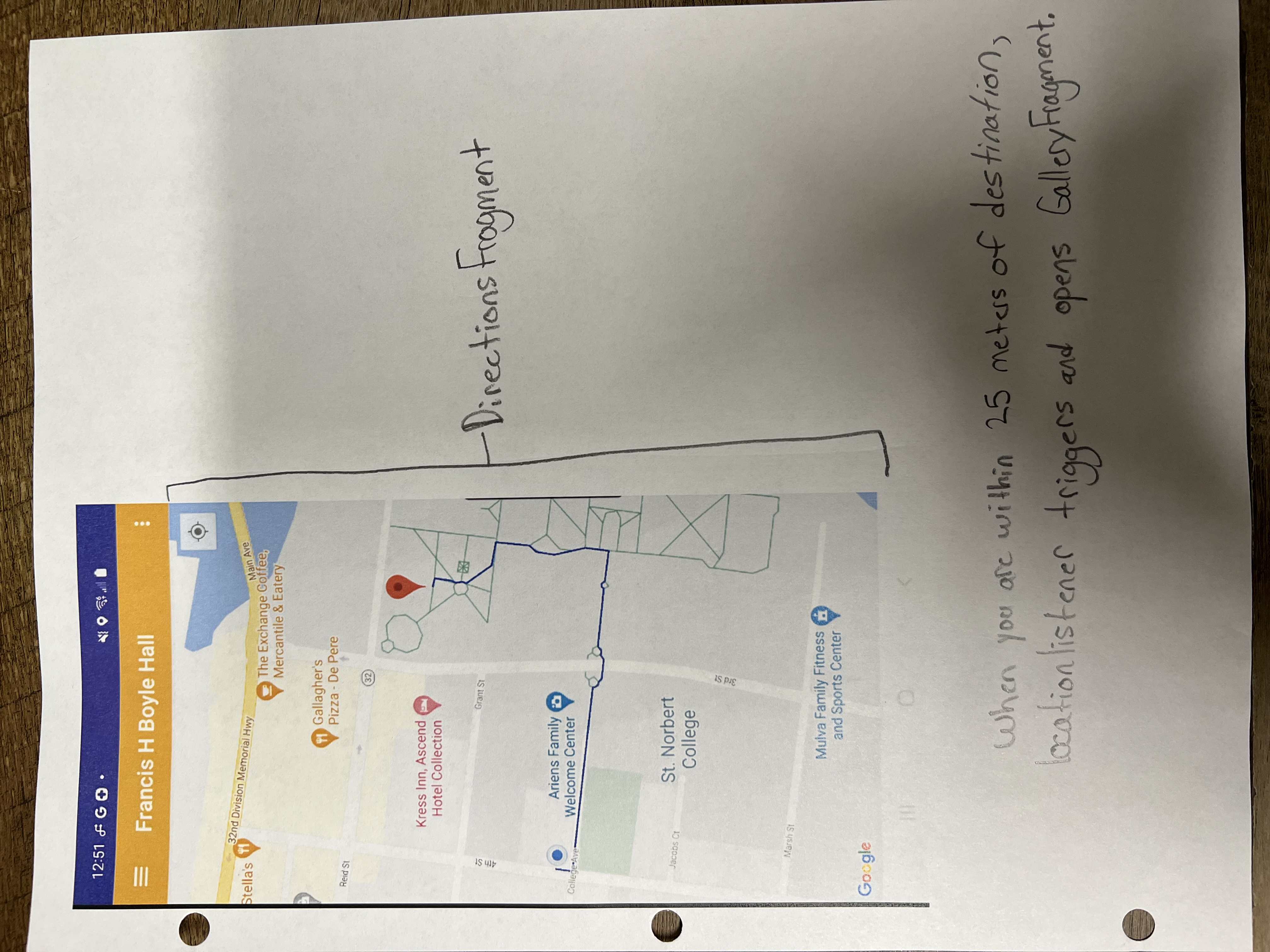
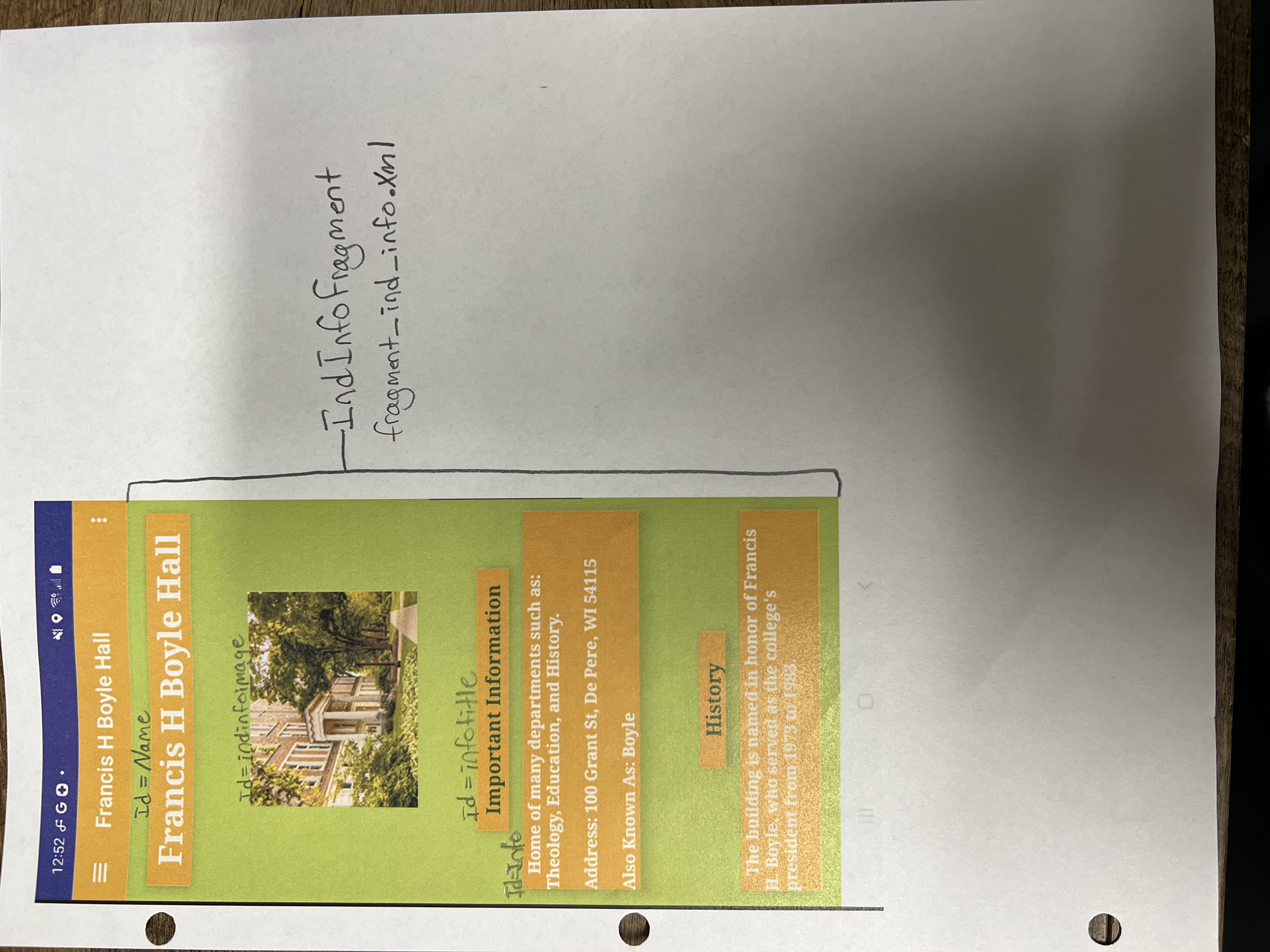
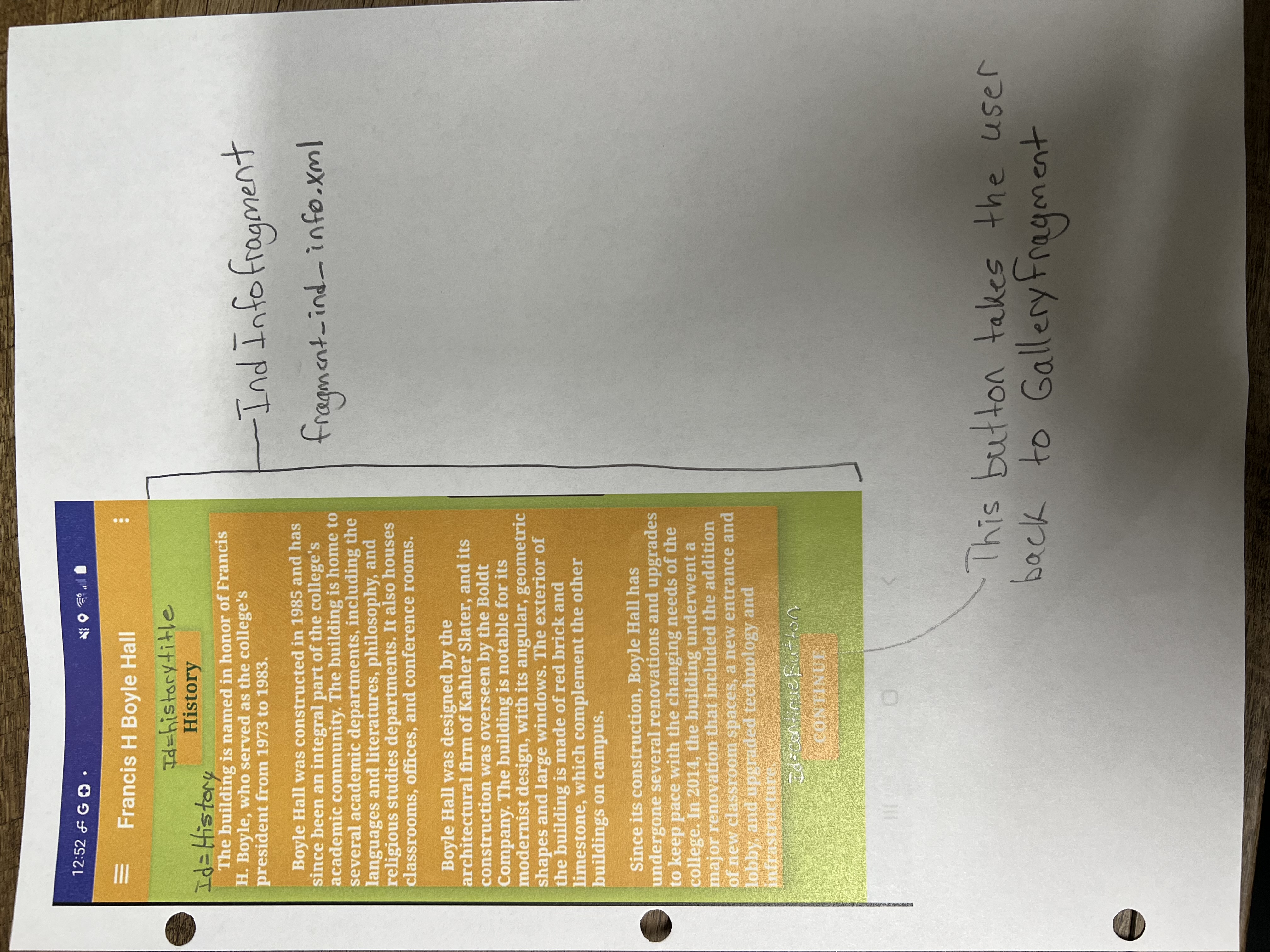
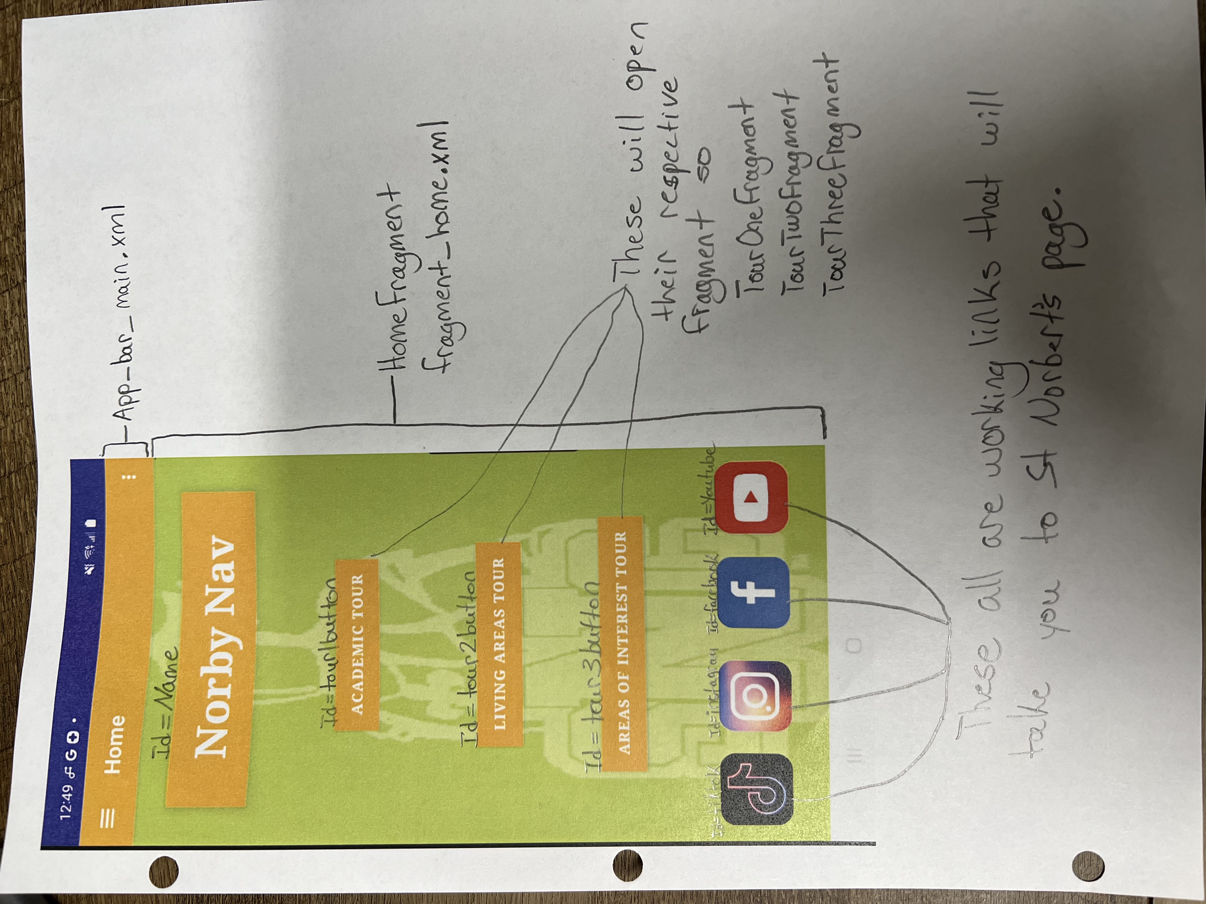
Below this are images of all the different screens in my application and a description of what elements each one has.