 |
GPS SYSTEMS |
|
|
GPS SYSTEMS |
|
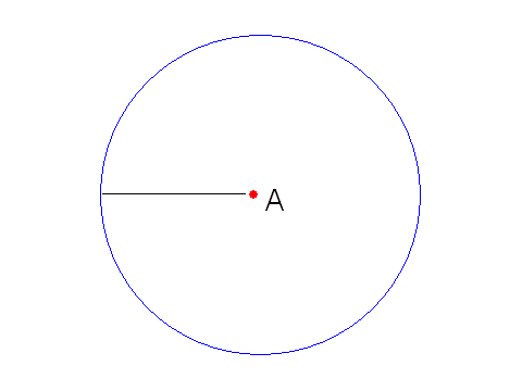
GPS works by triangulation, or trilateration as it is commonly referred to when speaking about three dimensions. To demonstrate, let's consider a two-dimensional moIf you did not know where you were, you could use three distances and the process of trilateration to deduce your location. Someone tells you that you are 25 miles from city A. You can now draw a circle, hypothetically, around city A with the radius equal to your distance from that city, 25 miles. You know that you are located somewhere on that circle.
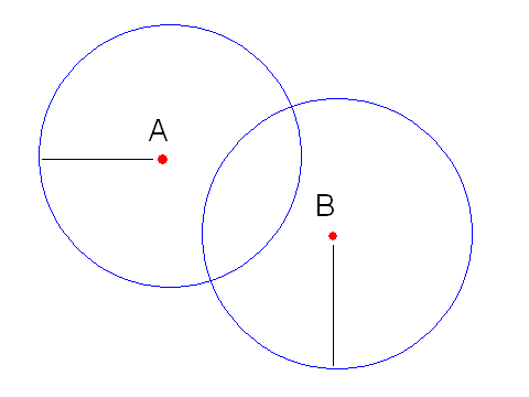
To further narrow down your location, you ask someone else who says that you are 20 miles from city B. Now you can draw another circle with radius 20 miles that will intersect the first at exactly two points, one of which will be your location.
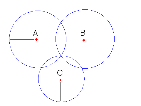
To determine which intersection you are at, you ask a third person who says that you are 15 miles from city C. Your third circle with radius 15 miles will intersect one of the prior intersections, noting your exact location.
With satellites and GPS receivers, trilateration is used. It follows the same basic principles, but uses spheres rather than circles. The first two distances will result in a perfect circle of possibilities and the third will narrow it to two points. One of these points will be infeasible, located in space, while the other will be feasible, located on Earth.
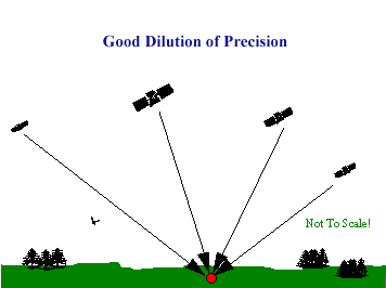
As explained on the Signal Problems page there are several external sources which introduce errors into a GPS position. While the errors discussed always effect accuracy, another major factor in determining positional accuracy is the alignment, or geometry, of the group of satellites from which signals are being received. The geometry of the constellation is evaluated for several factors, all of which fall into the category of Dilution Of Precision (DOP).
DOP is an indicator of the quality of the geometry of the satellite constellation. Your computed position can vary depending on which satellites you use. Different satellite geometries can magnify or lessen the errors of accuracy. A greater angle between the satellites lowers the DOP, and provides a better measurement. A higher DOP indicates poor satellite geometry, and an inferior measurement cofiguration
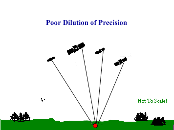
Some GPS receivers can analyze the positions of the satellites available, and choose those satellites with the best geometry in order to make the DOP as low as possible. Some GPS receivers also have a feature that is capable of ignoring or eliminating GPS readings with DOP values that exceed user-defined limits. Other GPS receivers may have the ability to use all of the satellites in view, thus minimizing the DOP as much as possible.
Top of Page --
Home--
GPS --
Accuracy --
GPS Satellite System
The Satellite Signal --
Sources of Signal Problems --
Printable Summary
Experimentation and Results --
Who We Are --
Project Sources