Project Description
The convex hull of a set of points is the smallest convex polygon that contains all the points of the set. It is important to note that any line that connects two points of this set is contained entirely in the convex hull of the set.
Project Task:
Develop an app that collects GPS coordinates and then displays the convex hull of the set of locations overlayed on a map.
Project Requirements
1. GPS coordinate collection
2. Construct convex hull
3. Illustrate convex hull as a map overlay
- Start
- Stop
- Continues to collect if in background
- Collects and stores coordinates for a specified time
- Stores up to N past sets of coordinates
2. Construct convex hull
- Design/explain and implement an algorithm that constructs the convex hull from a given set of points
- Store the data (points and convex hull) in a file
3. Illustrate convex hull as a map overlay
- Use different colors for different collections
- Show coordinates of vertices, when requested
- Show intersection of N convex hulls
- Show convex hull for the union of some or all sets
- Approximate and display the area enclosed in the convex hull, when requested
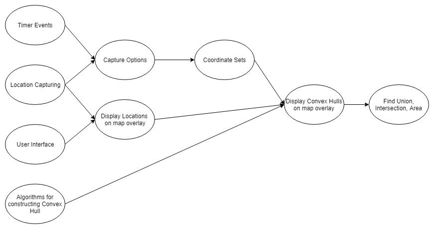
PERT Chart
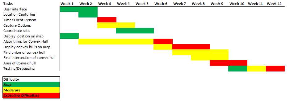
Gantt Chart